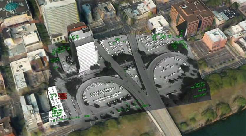
Maxar develops GPS-free navigation for drones and airplanes — sensor data is compared to a 3D map
Copy and paste this URL into your WordPress site to embed
Copy and paste this code into your site to embed