Wiki
Scientists are trying to understand the reasons for the rapid rise in water levels in Tibetan lakes, which threatens the region with large-scale flooding.
Satellite images, taken over many decades, indicate that the rapid rise in water levels in Tibetan lakes is influenced by changes in precipitation, as well as — melting of glaciers. Water levels are rising most rapidly in lakes in the northern Tibetan highlands. At a time when lakes around the world have been shrinking over the past 30 years, this highland region is experiencing a rapid rise in water levels and an increase in the area covered by water.
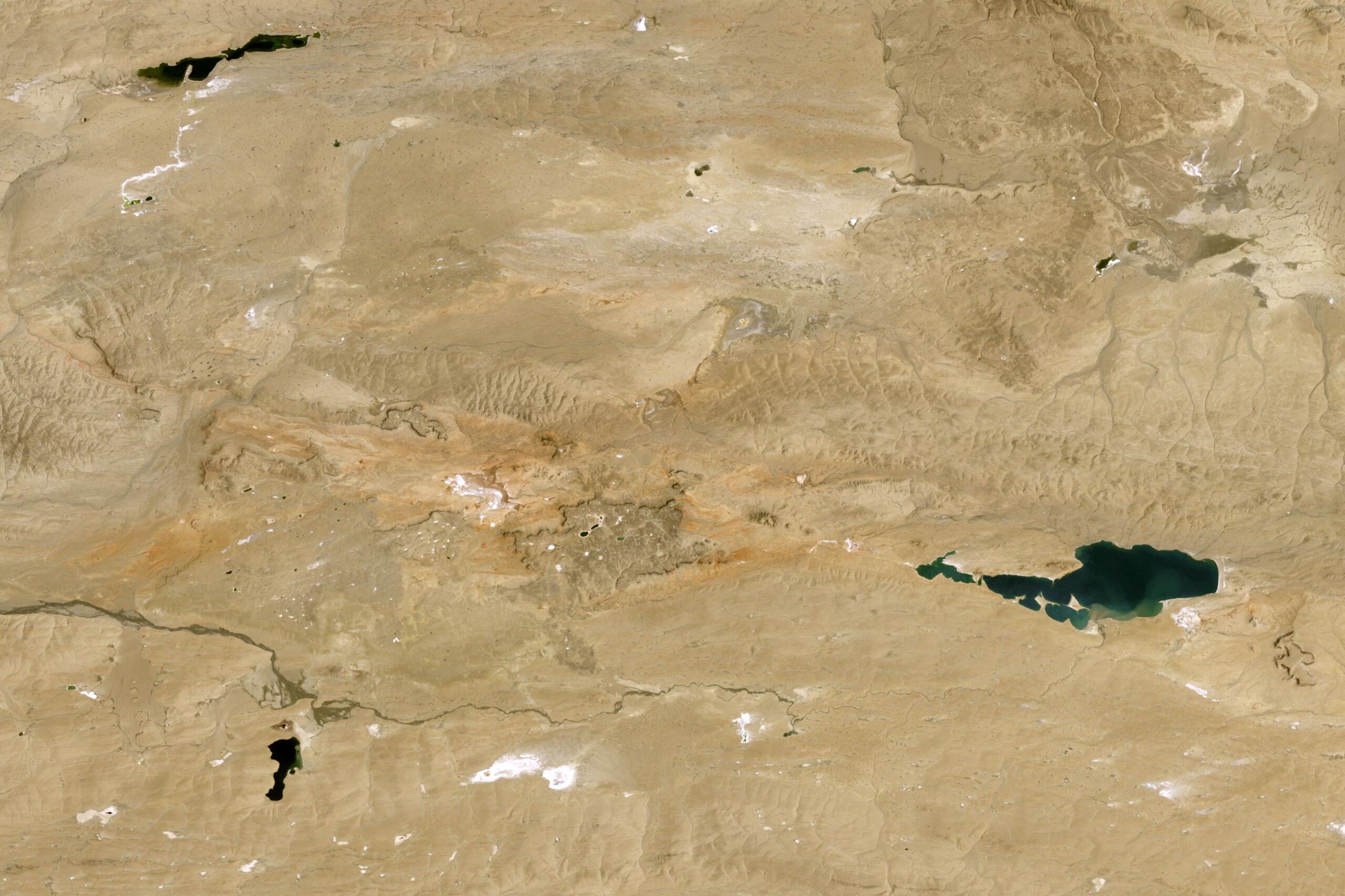
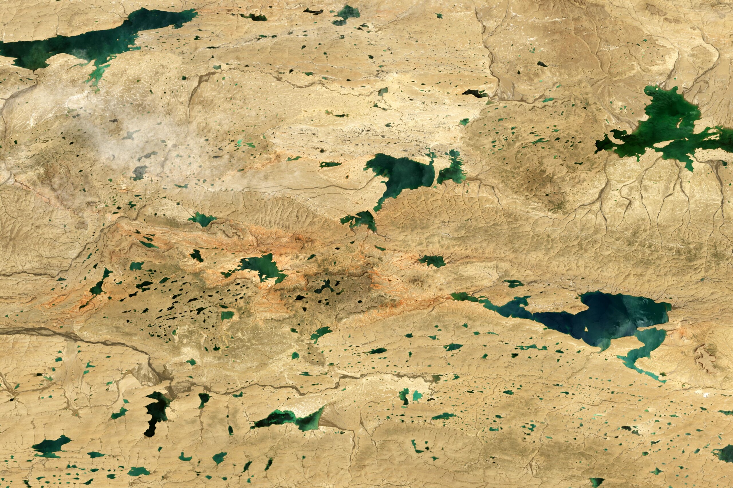
Satellite images demonstrate dramatic changes in the situation in the provinces Nima and Tsiemo, as well as — in the Changtan region of southwestern China. An image taken by Landsat 5 back in 1994 and a photo from Landsat 9 taken in August 2024 show a significant increase in the area covered by lakes in these areas.
Since the 1970s, satellites under the NASA program Landsat sends images of the Tibetan Plateau, providing scientists with the necessary data set for analysis.
In a study conducted in 2024 on climate change in the The study of the Tibetan Plateau notes that as of 1991, there were about 4,385 lakes in the region, each covering an area of about 100 square meters. Of these, only 4.2% covered an area of 10 to 50 square kilometers, and 2.9% exceeded 50 square kilometers. The total area occupied by them was 37,471 square kilometers.
As of 2023, the region has already recorded an increase in the number of lakes to 6,159 with a total area of 53,267 square kilometers.
These lakes are particularly sensitive to changes in water levels, because they are not connected to other waterways. They are filled by precipitation, seasonal melting of glacial ice and frozen ground. The water level is also affected by the rate of evaporation.
A number of researchers are convinced that the growth of the area of lakes in the The Tibetan highlands are most affected by intense precipitation. Others argue that the rising global temperature is to blame, melting of glaciers and permafrost.
A group of scientists predicts that further expansion of the lakes could lead to the region facing large-scale flooding by 2100 Hundreds of kilometers of roads, hundreds of settlements, and 10,000 square kilometers of meadows, wetlands, and arable land could be underwater.
«The dramatic increase in lake area will lead to flooding of people’s homes, displacement of livestock, and make some glacial lakes vulnerable to flash floods The Tibetan highlands are a very remote, harsh environment. Satellites, such as Landsat, are the only way to observe changes in numerous lakes and over long periods of time», — warns is a researcher at the University of Colorado at Boulder and lead author of the study, Fanfang Yao.
The study was published in the journal Science
Source: SciTech Daily
Контент сайту призначений для осіб віком від 21 року. Переглядаючи матеріали, ви підтверджуєте свою відповідність віковим обмеженням.
Cуб'єкт у сфері онлайн-медіа; ідентифікатор медіа - R40-06029.